 MASTERING CHARPLOTTER FUNCTIONS: TIPS AND TRICKS FOR ANGLERS
INTRODUCTION
As an angler, having a GPS chartplotter onboard greatly enhances your fishing experience. These powerful devices offer a wealth of functions and features that can help you navigate, locate fishing hotspots, and make the most of your time on the water.
In this comprehensive guide, we will provide you with tips and tricks to master the functions of your GPS chartplotter. Whether you prefer DIY maintenance, enjoy life on the water, or seek a touch of luxury, we have got you covered. Let's dive in and unlock the full potential of your chartplotter for an unforgettable fishing adventure.
TABLE OF CONTENTS:
- Understanding Your Chartplotter
- The Basics of GPS Chartplotters for Anglers
- Accurate Positioning with GPS
- Navigating with Detailed Maps
- Waypoints and Routes
- Gear and Tools You'll Need for Installing Your GPS Chartplotter
- Tips and Tricks for Mastering Your Chartplotter
- Optimizing Chartplotter Settings for Fishing
- Harnessing Waypoints and Routes
- Other Features and Integrations
- Common Chartplotter Issues
- Signal Interference
- Software/Map Updates
- Power Supply Problems
- User Interface and Menu Complexity
- Installation and Mounting Issues
- Upgrade Your Chartplotting Capabilities at Angler’s World
UNDERSTANDING YOUR CHARTPLOTTER
The Basics of GPS Chartplotters for Anglers
Before diving into the tips and tricks, let's start with a brief overview of GPS chartplotters and their essential functions for anglers.
Accurate Positioning with GPS
GPS chartplotters utilize satellite signals to provide accurate positioning information on the water. Understanding the basics of GPS technology and how it relates to your chartplotter is essential for maximizing its capabilities.
Navigating with Detailed Maps
One of the key functions of a chartplotter is its ability to display detailed maps. These maps, which include nautical charts, bathymetric data, and points of interest, allow you to navigate waterways, identify potential fishing spots, and stay safe on the water.
Waypoints and Routes
Waypoints and routes are invaluable tools for anglers. Learn how to mark and save waypoints for productive fishing spots, create and follow routes, and utilize these features to plan your fishing trips effectively.
GEAR AND TOOLS YOU'LL NEED FOR INSTALLING YOUR GPS CHARTPLOTTER
Essential Gear and Tools for Mastering Your Chartplotter
To properly setup your GPS chartplotter, you'll need the following gear and tools:
- GPS Chartplotter
- Mounting Bracket or Arm
- Power Source
- Antenna and GPS Receiver
- Cables and Connectors
Explore the selection of GPS chartplotters and essential gear at Angler's World, and find everything you need to elevate your fishing experience!
TIPS AND TRICKS FOR MASTERING YOU CHARTPLOTTER
Optimizing Chartplotter Settings for Fishing
Before you head out on the water, it’s important to setup your chartplotter up properly:
- Adjusting Screen Brightness: Find the optimal screen brightness to ensure clear visibility in different lighting conditions on the water. Avoid overly bright settings that can cause eye fatigue or dim settings that make it hard to read the screen.
- Customizing Data Overlays: Take advantage of the customizable data overlays on your chartplotter. Configure the display to show relevant information such as water temperature, depth, speed, and wind direction to make informed decisions while fishing.
- Setting Up Alarms: Utilize the alarm features of your chartplotter to enhance safety and fishing efficiency. Set anchor drag alarms, shallow water alarms, or waypoint arrival alarms to be notified of important events while focusing on your fishing activities.
Harnessing Waypoints and Routes
- Scout and Explore New Areas: Use your chart plotter to scout and explore new fishing areas. Whether you're inshore or offshore, maintain tracks while searching for bait concentrations, bird activity, or other signs of fish.
- Marking Productive Waypoints: When you come across a productive fishing spot, mark it as a waypoint on your chartplotter. Assign meaningful names or symbols to easily identify the locations for future reference.
- Creating Fishing Routes: Plan your fishing trips in advance by creating routes on your chartplotter. Plot a course that takes you through multiple fishing spots or follows a specific path, making your fishing trips more organized and efficient.
- Utilizing Depth Contours: Take advantage of the depth contour lines on your chartplotter to identify underwater structures, drop-offs, and potential fish-holding areas. Adjust the settings to highlight specific depth ranges that are relevant to your target species.
- Utilize Tracks to Pattern Fish: One of the key features of a chart plotter is the ability to create and follow tracks. By using tracks, you can analyze the direction and trends of fish movement. When you locate bait concentrations or notice specific bird activity, drop waypoints along the track to mark these hot spots. Over time, this data will build a comprehensive picture that guides you to productive fishing grounds.
- Optimize Trolling Techniques: Connect your chart plotter to your trolling motor for enhanced efficiency. By utilizing tracks or tracing contour lines, you can precisely control your trolling motor to maintain a specific depth or follow productive underwater structures. This allows you to focus on fishing while the chart plotter handles navigation, increasing your chances of attracting and hooking fish.
Other Features and Integrations
- Take Advantage of Advanced Features: Modern chart plotters offer advanced features such as weather data integration, temperature mapping, and bottom composition analysis. Use these features to your advantage. Monitor weather conditions for optimal fishing windows and identify temperature variations or changes in bottom composition that may attract fish.
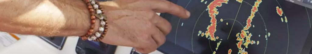
- Connecting with Other Marine Electronics: If you have other marine electronics onboard, such as fish finders or radar systems, explore the possibilities of integrating them with your chartplotter. This integration can provide a more comprehensive view of the environment and enhance your fishing capabilities.
- Exploring Chartplotter Apps and Updates: Stay up to date with the latest chartplotter software updates and explore additional apps or features offered by the manufacturer. These updates often introduce new functionalities and improve the overall performance of your chartplotter.
- Backing Up Waypoints and Settings: Regularly back up your waypoints, routes, and customized settings to prevent loss of valuable data. Consult your chartplotter's user manual or manufacturer's guidelines to learn how to perform backups and restore data if needed.
COMMON CHARTPLOTTER ISSUES
While most chartplotters are built to endure the harsh marine environment, these devices do run into common issues from time to time. Here are some of the most common GPS chartplotter you’ll eventually come across:
Signal Interference
GPS chartplotters may experience signal interference from obstacles such as tall buildings, dense tree cover, or other electronic devices, leading to inaccurate positioning or loss of signal altogether.
Software/Map Updates
Outdated software or maps can cause compatibility issues and inaccuracies. Keeping the chartplotter's software and maps up to date is essential for accurate navigation.
Power Supply Problems
Inadequate power supply, loose connections, or faulty wiring can result in intermittent power or complete shutdowns of the chartplotter, disrupting navigation.
User Interface and Menu Complexity
Some chartplotters have complex user interfaces and menus, which can be challenging for users to navigate and access specific functions or settings.
Installation and Mounting Issues
Incorrect installation or improper mounting of the chartplotter can lead to vibration, poor visibility, or limited access to controls, impacting the functionality and user experience.
UPGRADE YOUR CHARTPLOTTING CAPABILITIES AT ANGLER'S WORLD
Mastering the functions of your GPS chartplotter is essential for anglers who want to confidently navigate the waters and maximize their fishing experience.
However, having the best gear when out on the water makes a big difference. Angler’s World offers plenty of top-rated brands like Raymarine, SI-TEX, and B&G offer high-quality chart plotters designed to meet the needs of anglers of all budgets and needs.
Raymarine Axiom Series
- Raymarine Axiom+ 12 - 12" MFD Chartplotter w/Navionics+ Chart [E70638-00-NAG]
- Raymarine Axiom+ 12 - 12" MFD w/Lighthouse North America Chart [E70638-00-102]
- Raymarine Axiom+ 12 - 12" MFD Chartplotter [E70638]
- Raymarine Axiom+ 9 - 9" MFD Chartplotter w/Navionics+ Chart [E70636-00-NAG]
- Raymarine Axiom+ 9 - 9" MFD Chartplotter [E70636]
- Raymarine Axiom+ 7 - 7" MFD Chartplotter w/Navionics+ Chart [E70634-00-NAG]
- Raymarine Axiom+ 9 9" MFD Chartplotter w/Lighthouse North America Chart [E70636-00-102]
- Raymarine Axiom+ 7 - 7" MFD Chartplotter w/Lighthouse North America Chart [E70634-00-102]
- Raymarine Axiom+ 7 - 7" MFD Chartplotter [E70634]
- Raymarine Axiom 12 - 12" MFD Chartplotter w/Navionics+ Chart [E70368-00-NAG]
- Raymarine Axiom 9 - 9" MFD Chartplotter w/Navionics+ North America Chart [E70366-00-NAG]
- Raymarine Axiom 7 - 7" MFD Chartplotter Only w/Navionics+ Chart [E70363-00-NAG]
- Raymarine Axiom 12 - 12" MFD Chartplotter [E70368]
- Raymarine Axiom 9 - 9" MFD Chartplotter [E70366]
- Raymarine Axiom 7 - 7" MFD Chartplotter [E70363]
BG Vulcan Series
SI-TEX NavPro Series
- SI-TEX NavPro 1200 w/Wifi - Includes Internal GPS Receiver/Antenna [NAVPRO1200]
- SI-TEX NavPro 900 w/Wifi - Includes Internal GPS Receiver/Antenna [NAVPRO900]
- SI-TEX Explorer NavPro w/Wi-Fi GPK-11 GPS Antenna [EXPLORERNAVPROWIFIW]
- SI-TEX Explorer NavPro w/Wi-Fi - No GPS Antenna [EXPLORERNAVPROWIFI]
SI-TEX GPS and Chartplotter Series
- SI-TEX GPS-915 Receiver - 72 Channel w/Large Color Display [GPS915]
- SI-TEX SVS-880CE 8" Chartplotter w/External GPS Antenna & Navionics+ Card [SVS-880CE]
- SI-TEX SVS-460CE Chartplotter - 4.3" Color Screen w/Internal External GPS Antennas Navionics+ Flexible Coverage [SVS-460CE]
- SI-TEX SVS-460C Chartplotter - 4.3" Color Screen w/Internal GPS and Navionics+ Flexible Coverage [SVS-460C]