 NAVIGATING THE WATERS: THE ESSENTIAL GUIDE TO GPS CHARTPLOTTERS FOR ANGLERS
When it comes to fishing, having a reliable GPS chartplotter is essential for navigating the waters and finding the best fishing spots. GPS chartplotters provide accurate positioning, detailed mapping, and advanced navigation features that can greatly enhance your fishing experience.
In this comprehensive guide, we will explore the world of GPS chartplotters and provide you with all the information you need to make an informed decision. Whether you prefer DIY maintenance, enjoy life on the water, or seek a touch of luxury, we have got you covered. Let's dive in and discover the essential guide to GPS chartplotters for anglers.
TABLE OF CONTENTS:
- Understanding GPS Chartplotters
- The Importance of GPS Chartplotters for Anglers
- Key Features and Benefits of GPS Chartplotters
- Accurate Positioning
- Detailed Mapping
- Waypoint Management
- Advanced Navigation Features
- Essential Gear and Tools for GPS Chartplotters
- GPS - Chartplotter Brands Available at Angler’s World
- Raymarine GPS Chartplotters: Performance and Reliability
- The Raymarine Axiom+ 12 - 12" MFD Chartplotter w/Navionics+ Chart [E70638-00-NAG]
- SI-TEX GPS Chartplotters: Versatility and User-Friendly Design
- SI-TEX NavPro 1200 w/Wifi
- B&G GPS Chartplotters: Precision and Sailing Features
- BG Vulcan 9 Radar Bundle w/HALO20 Radar
UNDERSTANDING GPS CHARTPLOTTERS
The Importance of GPS Chartplotters for Anglers
GPS chartplotters are invaluable tools for anglers, offering advanced navigation capabilities and detailed mapping to help you navigate waterways, mark waypoints, and locate productive fishing spots.
These devices combine GPS technology with chartplotting functionality, providing you with accurate positioning, real-time tracking, and access to valuable information like depth data and marine charts. Whether you are a recreational boater, a fishing enthusiast, or a professional angler, a GPS chartplotter can greatly enhance your fishing adventures.
Key Features and Benefits of GPS Chartplotters
Accurate Positioning
GPS chartplotters utilize satellite signals to provide precise positioning information, allowing you to navigate with confidence and accuracy on the water.
Detailed Mapping
GPS chartplotters offer detailed maps that include nautical charts, bathymetric data, and points of interest. These maps help you understand the underwater terrain, identify fishing hotspots, and navigate safely.
Waypoint Management
With GPS chartplotters, you can easily mark and manage waypoints, which are specific locations you want to remember. Whether it's a productive fishing spot, a favorite wreck, or a scenic location, you can save and revisit waypoints for future trips.
Advanced Navigation Features
GPS chartplotters often come with advanced navigation features such as:
- Route planning
- Automatic routing
- Weather overlays
- And more
These features help you plan your fishing trips, avoid obstacles, and make informed decisions based on real-time weather data.
ESSENTIAL GEAR AND TOOLS FOR GPS CHARTPLOTTERS
To optimize your GPS chartplotter experience, you'll need the following gear and tools:
- GPS Chartplotter: Select a high-quality GPS chartplotter that suits your fishing needs and preferences. Consider factors such as screen size, resolution, ease of use, chart availability, and compatibility with other marine electronics.
- Mounting Bracket or Arm: A sturdy mounting bracket or arm is crucial for securely installing the chartplotter on your boat. Ensure compatibility with your chosen chartplotter and consider factors such as adjustability and stability.
- Power Source: Determine the power requirements of your chartplotter and ensure you have the necessary power source, such as a dedicated circuit or appropriate wiring, to provide reliable and uninterrupted power.
- Antenna and GPS Receiver: Depending on the chartplotter model, you may need an external GPS antenna or receiver to improve signal reception and accuracy. Consult the manufacturer's recommendations for compatible accessories.
- Cables and Connectors: Use high-quality marine-grade wiring and connectors to connect the chartplotter to the power source, GPS antenna, and other marine electronics. Opt for marine-rated, corrosion-resistant options for durability.
Explore the selection of GPS chartplotters and essential gear at Angler's World, and find everything you need to elevate your fishing experience!
GPS - CHARTPLOTTER BRANDS AVAILABLE AT ANGLER'S WORLD
Raymarine GPS Chartplotters: Performance and Reliability
Raymarine is a renowned brand in the marine industry, known for its performance and reliability. The company offers a range of GPS chartplotters designed to meet the needs of anglers.

The Raymarine Axiom+ 12 - 12" MFD Chartplotter w/Navionics+ Chart [E70638-00-NAG]
The Raymarine Axiom+ 12 - 12" MFD Chartplotter w/Navionics+ Chart [E70638-00-NAG] is a high-performance marine chartplotter that combines advanced features with a large display for a seamless navigation experience. With its integrated Navionics+ chart, this device provides detailed and up-to-date mapping data. The Axiom+ 12 features a user-friendly interface, powerful processing capabilities, and multiple connectivity options for enhanced functionality. Its durable construction, intuitive controls, and advanced navigation features make it a reliable and versatile choice for boating enthusiasts.
Key Features:
- 12" High-Resolution Display: Offers a large, high-definition screen for clear visibility and detailed mapping information.
- Navionics+ Chart: Comes preloaded with Navionics+ chart for comprehensive and up-to-date mapping data.
- User-Friendly Interface: Features an intuitive and easy-to-use interface for seamless navigation and control.
- Powerful Processing: Equipped with a high-performance processor for fast and responsive operation, ensuring smooth navigation and real-time data processing.
- Versatile Connectivity: Offers multiple connectivity options, including Wi-Fi, Bluetooth, and NMEA 2000, for easy integration with other devices and sensors.
OTHER GREAT RAYMARINE GPS CHARTPLOTTERS AVAILABLE AT ANGLER'S WORLD
- Raymarine Axiom+ 12 - 12" MFD w/Lighthouse North America Chart [E70638-00-102]
- Raymarine Axiom+ 12 - 12" MFD Chartplotter [E70638]
- Raymarine Axiom+ 9 - 9" MFD Chartplotter [E70636]
- Raymarine Axiom+ 9 - 9" MFD Chartplotter w/Navionics+ Chart [E70636-00-NAG]
- Raymarine Axiom+ 7 - 7" MFD Chartplotter w/Navionics+ Chart [E70634-00-NAG]
- Raymarine Axiom+ 9 9" MFD Chartplotter w/Lighthouse North America Chart [E70636-00-102]
- Raymarine Axiom+ 7 - 7" MFD Chartplotter w/Lighthouse North America Chart [E70634-00-102]
- Raymarine Axiom+ 7 - 7" MFD Chartplotter [E70634]
- Raymarine Axiom 12 - 12" MFD Chartplotter w/Navionics+ Chart [E70368-00-NAG]
- Raymarine Axiom 9 - 9" MFD Chartplotter w/Navionics+ North America Chart [E70366-00-NAG]
- Raymarine Axiom 7 - 7" MFD Chartplotter Only w/Navionics+ Chart [E70363-00-NAG]
- Raymarine Axiom 12 - 12" MFD Chartplotter [E70368]
- Raymarine Axiom 9 - 9" MFD Chartplotter [E70366]
- Raymarine Axiom 7 - 7" MFD Chartplotter [E70363]
SI-TEX GPS Chartplotters: Versatility and User-Friendly Design
SI-TEX offers a range of GPS chartplotters known for their versatility and user-friendly design, making them a popular choice among anglers.
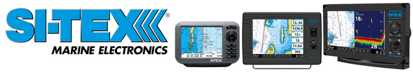
SI-TEX NavPro 1200 w/Wifi
The SI-TEX NavPro 1200 w/Wifi is a powerful marine navigation device designed to enhance your boating experience. With its integrated GPS receiver/antenna and built-in Wifi connectivity, this device offers accurate positioning information and seamless access to software updates, charts, and weather data. The NavPro 1200 boasts a large display for clear visibility, while its user-friendly interface simplifies navigation and control. Additionally, it supports AIS integration, NMEA 2000 compatibility, and offers waypoint management capabilities. With its durable construction and easy installation, the NavPro 1200 is a reliable and feature-packed choice for marine enthusiasts.
Key Features:
- Integrated GPS Receiver/Antenna: Provides accurate positioning information without the need for external devices.
- Wifi Connectivity: Enables wireless access to software updates, charts, and weather data.
- Large Display: Offers a clear and detailed view of navigation information in various lighting conditions.
- AIS Support: Displays AIS targets for improved situational awareness and collision avoidance.
- Waypoint Management: Allows users to mark and save points of interest, waypoints, routes, and tracks for easy navigation and reference.
OTHER GREAT SI-TEX GPS CHARTPLOTTERS AVAILABLE AT ANGLER'S WORLD
- SI-TEX NavPro 900 w/Wifi - Includes Internal GPS Receiver/Antenna [NAVPRO900]
- SI-TEX Explorer NavPro w/Wi-Fi GPK-11 GPS Antenna [EXPLORERNAVPROWIFIW]
- SI-TEX Explorer NavPro w/Wi-Fi - No GPS Antenna [EXPLORERNAVPROWIFI]
- SI-TEX GPS-915 Receiver - 72 Channel w/Large Color Display [GPS915]
- SI-TEX SVS-880CE 8" Chartplotter w/External GPS Antenna & Navionics+ Card [SVS-880CE]
- SI-TEX SVS-460CE Chartplotter - 4.3" Color Screen w/Internal External GPS Antennas Navionics+ Flexible Coverage [SVS-460CE]
- SI-TEX SVS-460C Chartplotter - 4.3" Color Screen w/Internal GPS and Navionics+ Flexible Coverage [SVS-460C]
B&G GPS Chartplotters: Precision and Sailing Features
B&G offers GPS chartplotters known for their precision and advanced sailing features, catering to anglers who also enjoy sailing.

BG Vulcan 9 Radar Bundle w/HALO20 Radar
The BG Vulcan 9 Radar Bundle w/HALO20 Radar [000-15620-001] is a comprehensive marine navigation system that combines a feature-rich chartplotter with a high-performance HALO20 radar. This bundle offers sailors and boaters advanced radar capabilities along with a powerful chartplotter for enhanced situational awareness and navigation. The Vulcan 9 features a large display, intuitive interface, and a range of connectivity options, while the HALO20 radar provides reliable target detection and superior performance. With this bundle, users can navigate confidently and stay safe on the water.
Key Features:
- Vulcan 9 Chartplotter: Equipped with a large, high-resolution display for clear and detailed mapping information, allowing for easy navigation and route planning.
- HALO20 Radar: Includes a high-performance HALO20 radar unit that offers reliable target detection, excellent range, and advanced features for enhanced situational awareness, even in adverse weather conditions.
- Intuitive Interface: The Vulcan 9 features an intuitive and user-friendly interface, making it easy to access and control various functions and settings.
- Advanced Connectivity: Offers versatile connectivity options, including Wi-Fi, Bluetooth, and NMEA 2000, allowing for seamless integration with other devices and sensors.
- Enhanced Safety and Navigation: The combination of the Vulcan 9 chartplotter and HALO20 radar provides boaters with advanced safety features, such as collision avoidance and real-time target tracking, ensuring a safer and more efficient navigation experience.
CONCLUSION
A GPS chartplotter is a valuable tool for anglers, providing accurate positioning, detailed mapping, and advanced navigation features. Brands like Raymarine, SI-TEX, and B&G offer top-quality GPS chartplotters designed specifically for fishing enthusiasts. When selecting a GPS chartplotter, consider factors such as accuracy, ease of use, and compatibility with other marine electronics.
Explore the selection at Angler's World and find the perfect GPS chartplotter to enhance your fishing experience.